1. Start to Fishbourne Meadows
Leave Fishbourne station to reach the road and turn right along the pavement. When you reach the pedestrian crossing, cross over to continue along the left-hand pavement and then take the first left turn into Roman Way. Continue past the school on your left and at the end of the road, you will reach the entrance to Fishbourne Roman Palace ahead.
The exterior appearance of this site belies its importance. The 1960s style buildings are home to the remains of a 1st Century Roman palace. In size, it is approximately equivalent to Nero’s Golden House in Rome (larger than Buckingham Palace) and is by far the largest known Roman residence north of the Alps. It is thought that there were mosaic floors in at least 100 of the rooms and on display within the museum is the largest collection of Roman mosaics in Britain, including one depicting Cupid riding a dolphin. Admission charges apply if you would like to visit.
Standing facing the vehicle entrance gate, fork left to join the fenced footpath running to the left of the museum’s entrance road (make sure you are on the separate footpath, NOT the pavement within the museum site itself). Beyond the palace site, you will come to a fingerpost and kissing gate. Follow the main tarmac path which swings right and then, when the path swings left, go straight ahead to pass through the gate to reach the road.
Cross over with good care (it can be busy and there is a pedestrian crossing a few hundred yards to the right if you need it) and go straight ahead through the kissing gate (signed as a public footpath). Follow the tarmac path which leads you over a stream and on to reach a kissing gate ahead, at the edge of Fishbourne Meadows.
2. Fishbourne Meadows to Inland Path
NOTE: You may come across cattle grazing within Fishbourne Meadows (these were once part of the Roman harbour linked to the palace). Pass through the gate to enter the first meadow and walk diagonally right (between 2 and 3 o’clock) to reach the gate at the furthest right corner of the field. Pass through the kissing gate and walk diagonally right, following the sleepers and then continuing with a fence and stream on your right. As you reach the field corner, go across a large footbridge over the stream, walk ahead for a few paces to reach the raised sleeper path and then turn right along this.
In the corner, go through the metal kissing gate and keep ahead on the stone path between properties, with the stream running on your right. Pass through the next gate and go ahead, passing The Old Mill on the left and the old mill pond on your right. Beyond the millpond, the path swings left and then leads you between tall, impressive reed beds, crossing three footbridges to reach a fingerpost.
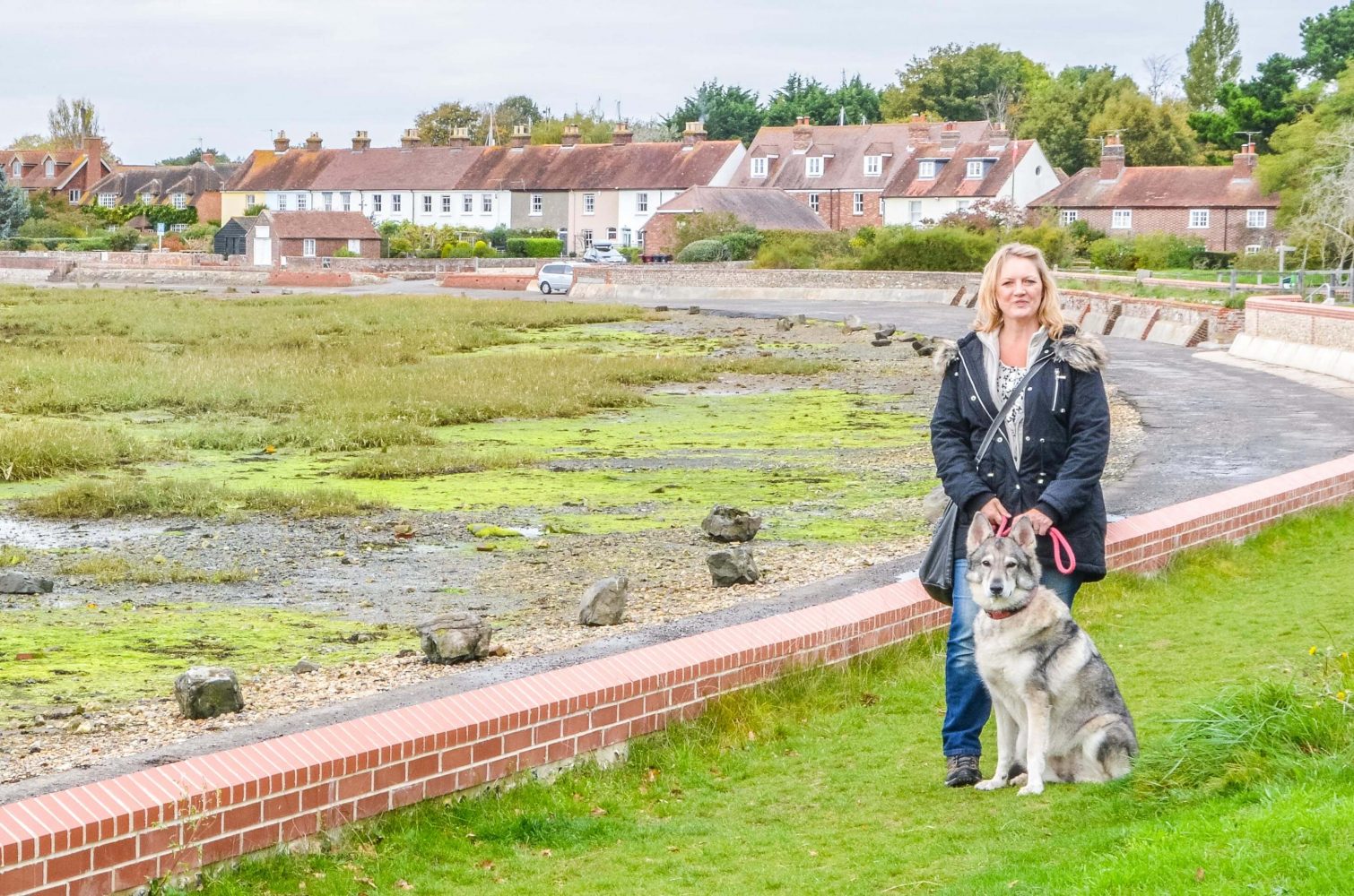
Stay on the signed footpath, to the left, following an embankment with fields to your right and the reed beds within Fishbourne Channel on the left. Soon the reed beds on the left give way to salt marshes and mudflats. With the tide out, the wading birds and stranded boats are the only clues that these mudflats disappear under the sea twice a day. Behind to your left, you will have a good view of the spire of Chichester Cathedral in the distance.
Further along, the path leaves the embankment and winds along the edge of the mudflats, leading you through some old oak trees. Continue over a sleeper bridge and beyond this the path bears right, leading you inland.
3. Inland Park to Park Lane
The path leads you through a section of dense hedgerow, packed with hawthorn and blackthorn. Beyond the hedgerows, continue straight ahead on the grass track with an open crop field to the right.
At the end of the first field, you will come to a T-junction, turn right, and follow the grass track between two crop fields. When the crop field on the left ends, turn left and follow the fenced path with a line of tall trees running on your right. At the end of this footpath, you will come to a junction with a quiet country lane, Park Lane.
4. Park Lane to Bosham Channel
Cross over with care and go straight ahead passing through the low, staggered barrier to join the next fenced section of footpath. Simply stay ahead on this path which eventually bends left to pass a single property on the right. Beyond the house, continue along the grass verge ahead and merge with the access drive for the house.
Follow the access drive and, where it bends left, do NOT follow it, instead walk ahead through the gap in the hedge, turn right over a bridge and then turn left over a second bridge. Keep directly ahead on the grass path which leads you through the centre of a crop field. At the end of the field, go down the steps, cross the quiet road and go straight ahead into the gravel driveway (passing a house on your left and its garage on your right). Walk ahead to join the narrow path between fences.
At the end of this path, cross over the quiet lane, walk directly ahead over the grass verge and you will come to the edge of Bosham Channel. Turn right along the tarmac path which leads you along the edge of the estuary.
5. Bosham Channel to Beach Path
Simply stay on the tarmac path, following the line of the sea wall on your left. The road below this wall floods at high tide and catches out many tourists! Eventually, the path leads you between houses and you will emerge to the junction with Bosham Lane, with the Old Town Hall on your left.
Go straight ahead on the small lane, leading you into the heart of the village to reach the pub, Anchor Bleu, on the left, an ideal lunch stop. Stay on the same lane which leads you past the village church on your right. Follow the lane over the stream and you will come to a T-junction with Quay Meadow ahead. Turn right along the lane and, just as it is about to swing right, turn left alongside a wooden gate (marked as Private Carriageway) – if you look carefully, you will notice the public footpath sign hidden in the privet hedge here.
Follow the gravel driveway, swinging right to pass between two properties, then bear left and follow the path down to reach the back of the beach. (NOTE: If the tide is too high to use this path, retrace your steps back to the Old Town Hall, turn left along Bosham Lane and follow it to the junction with Moreton Road, where you can pick up the main route once again).
6. Beach Path to Frenchams
Turn right along the stone path at the back of the beach (taking care as it can be slippery) with the quay wall running on the right. Continue until you reach the remains of a small concrete pier within the estuary. Turn right here (passing a house on your right) then keep ahead, heading back inland with a tall line of trees running across to your right. Pass alongside a metal gateway and continue ahead to reach the junction with Moreton Road. Turn right and continue down to the T-junction between Moreton Road and Bosham Lane (with a pair of thatched cottages on the right).
Cross over and turn left along the pavement. (NOTE: If you have taken the detour along Bosham Lane, stay on the lane as it swings right and then follow the instructions from this point). Further along, as you reach Critchfield House, you will be forced to swap to the left-hand pavement. Keep straight ahead, passing the second village pub (The Berkley Arms) on the left. Continue straight ahead, signed to Bosham Hoe.
The lane leads you past the school on your left and then, when the pavement ends, walk along the right-hand road edge (taking particular care of traffic as you approach the bend). Where the road bends left, go ahead onto the signed public footpath (passing Frenchams on your right).
7. Frenchams to End
Simply keep ahead on this grass path, passing a crop field on your left and then a large glasshouse complex, also on your left. Beyond this complex, ignore the path on the left, simply keep ahead on the main grass path. At the end of the field, go straight ahead onto the tree-lined track. The track soon opens out to follow a beautiful line of tall, ivy-clad trees on your right and an open crop field on your left.
Follow this track all the way to its end where it meets a junction with a road. Keep straight ahead along the quiet residential lane and soon it will lead you to a T-junction with the main road. Turn right along the pavement and continue along the road until you reach Bosham Dental Clinic on your right. Here you will find a designated crossing point that allows you to swap to the lefthand pavement. Continue past the bus stop and then turn left into the side road, signed to the Roman Palace and Fishbourne Station. Follow Salthill Road for 0.25 miles to reach the station where the walk began.